The World Lighthouse Hub
A09: The Vatican Gallery of Maps
In 1580, as part of a larger project to decorate the Vatican, Pope Gregory XIII invited a famous geographer, Ignazio Danti (1536-86), to Rome to supervise the painting of what would become the Gallery of Maps. This breathtaking room, approximately sixty metres long and eight metres wide, can be visited as part of the Vatican museum tour. Under the supervision of Danti, between 1580 and 1585, forty large paintings and an intricately painted vaulted ceiling were created for the room.
The paintings map the entire Italian peninsula, including much coastline and the major ports. But the paintings are remarkable for being more than just maps. For example, an anonymous poet, celebrating the gallery's opening, wrote, “Each region is placed under its ruling planet and occupies an entire panel which shows the cities, castles, and villages with their streets and houses huddled together. Neither are the rivers forgotten, nor the springs, steep valleys and gentle hills, the green shade of the woods, the windswept shores, and the green expanses of sea that truly seem to move....” From our point of view, the maps are significant because of the way lighthouses are depicted.
All of the following photographs were taken in the Gallery of Maps in theVatican Museum. [Ken Trethewey, 2003]
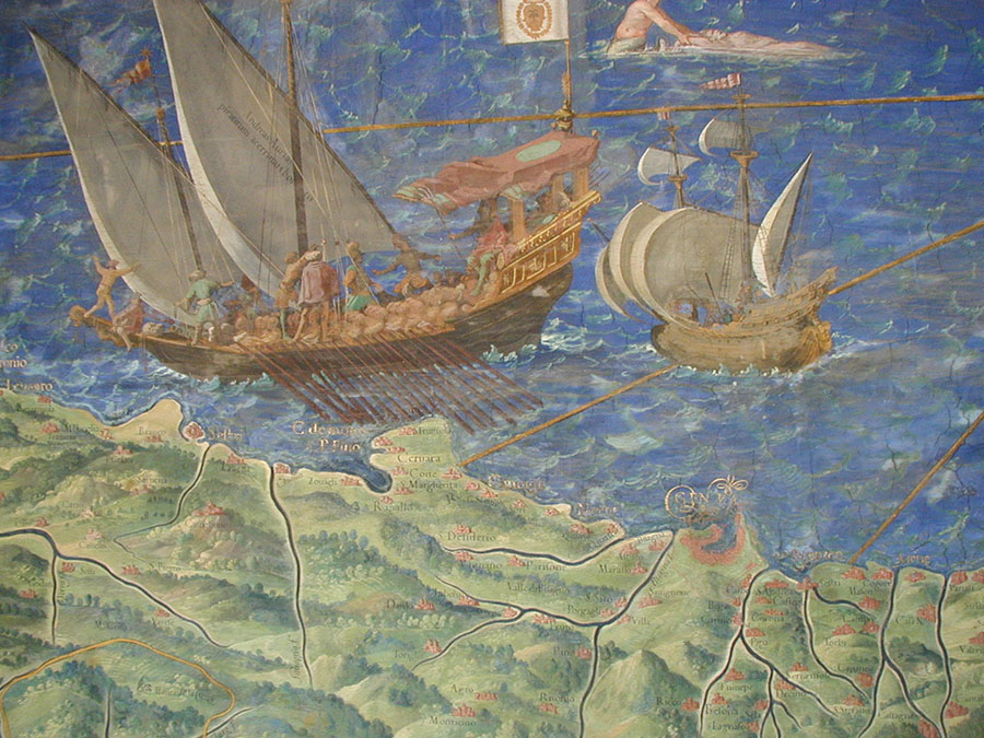
The above map is a general view of the region around Genoa.
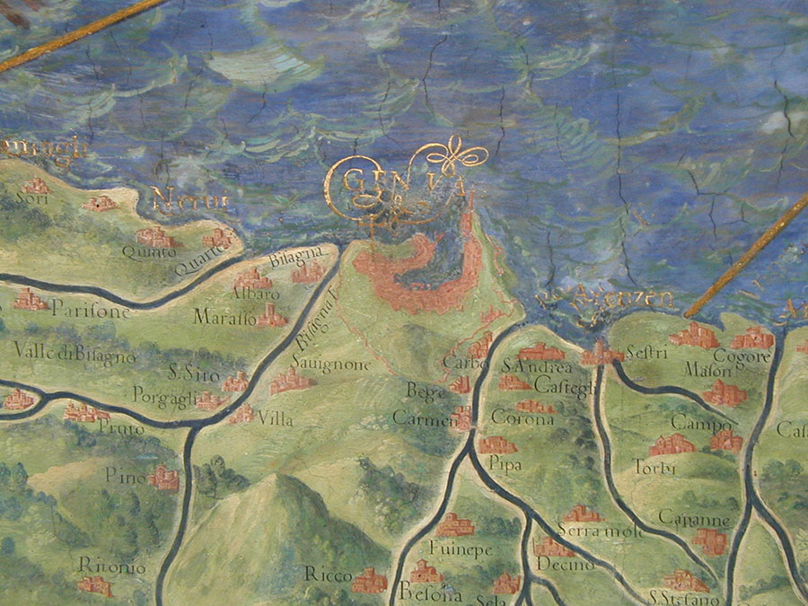
The map above is a closeup taken from the map of Genoa.
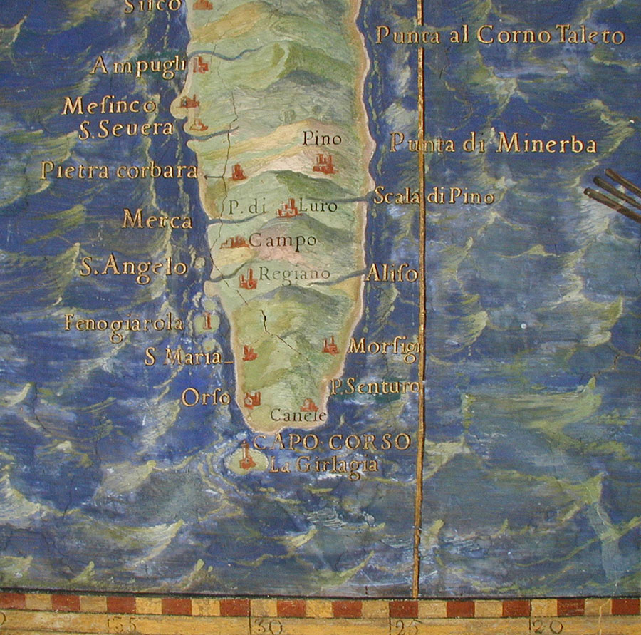
The map above is from the painting in the Gallery of Maps, Vatican Museum, showing the region of Capo Corso and the lighthouse at La Giraglia on the northern tip of Corsica. (North is downwards on this map.) It is interesting to see that significant structures such as towers (possibly lighted) are present at many of the prominent points on the coastline. This may indicate that lighted navigational aids were more numerous than might be expected. [Ken Trethewey, 2003]
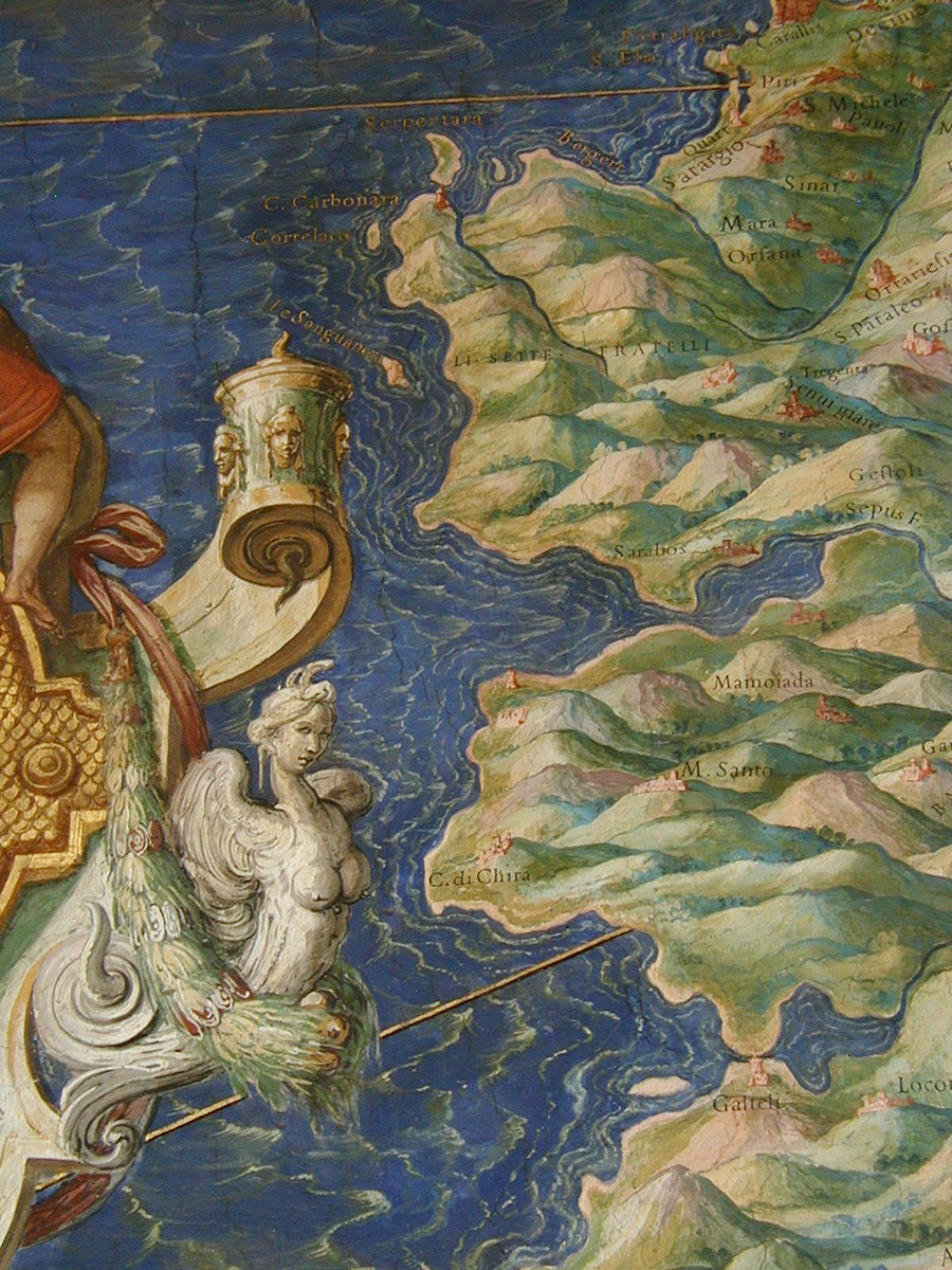
Above is the map including Cabo Carbonara.
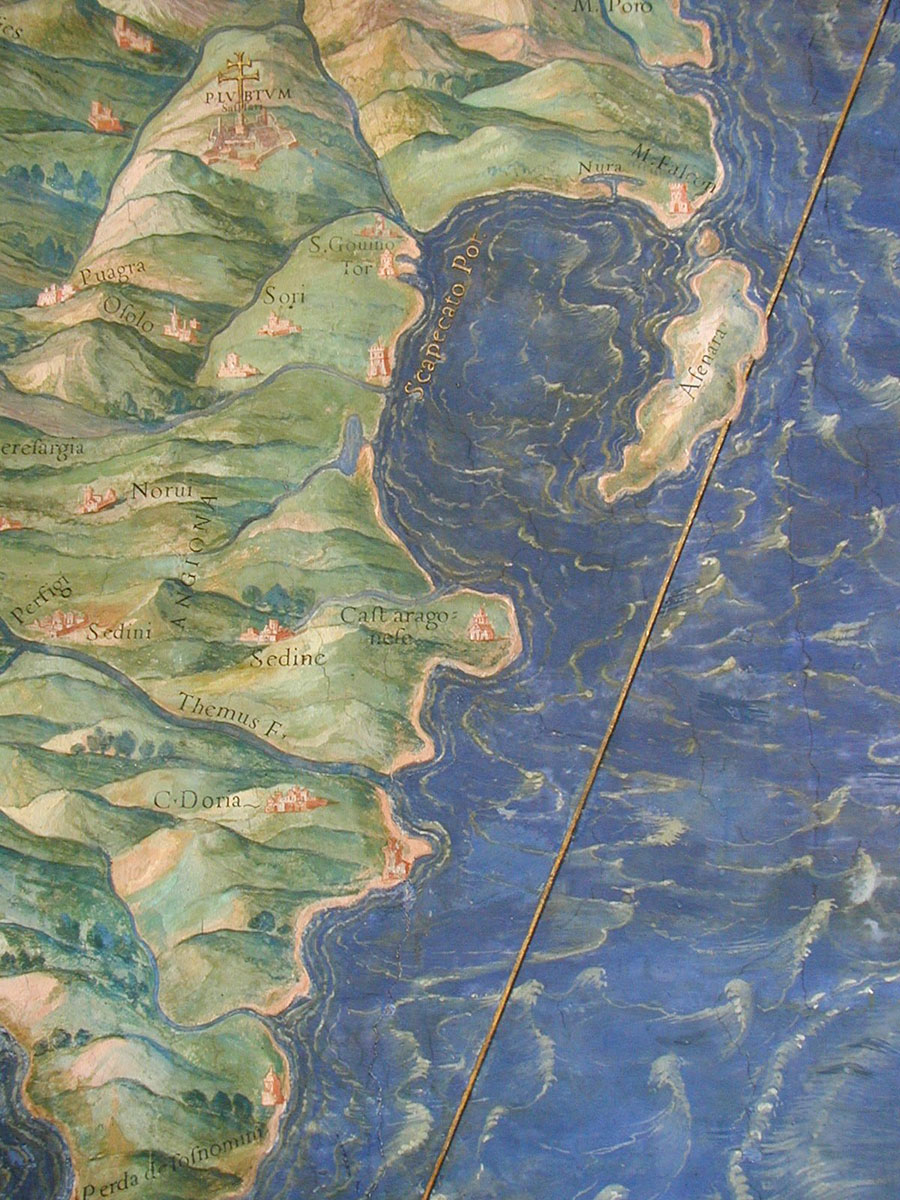
The bay is centred on Porto Torres in Sardinia and the region of Anglona is on the left. Again, north is downwards on this painting.
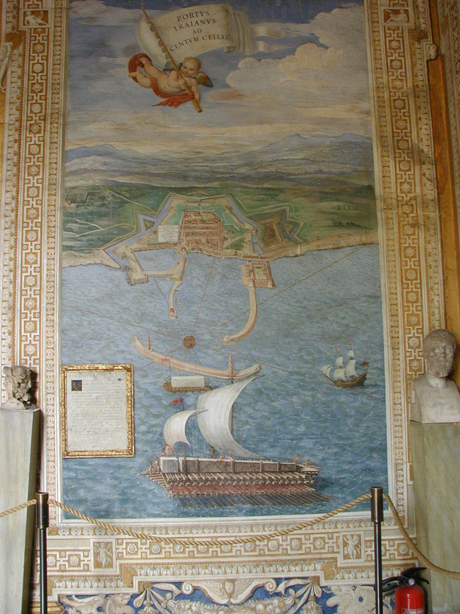
This wonderful painting is of Centum Cellae (Civitavecchia). The grand scale of the work is clear.
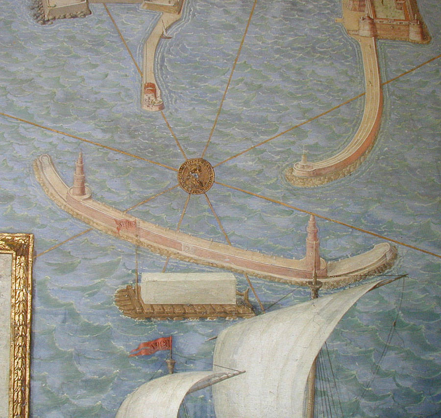
This detail of the previous map shows the harbour, breakwater and lighthouses.
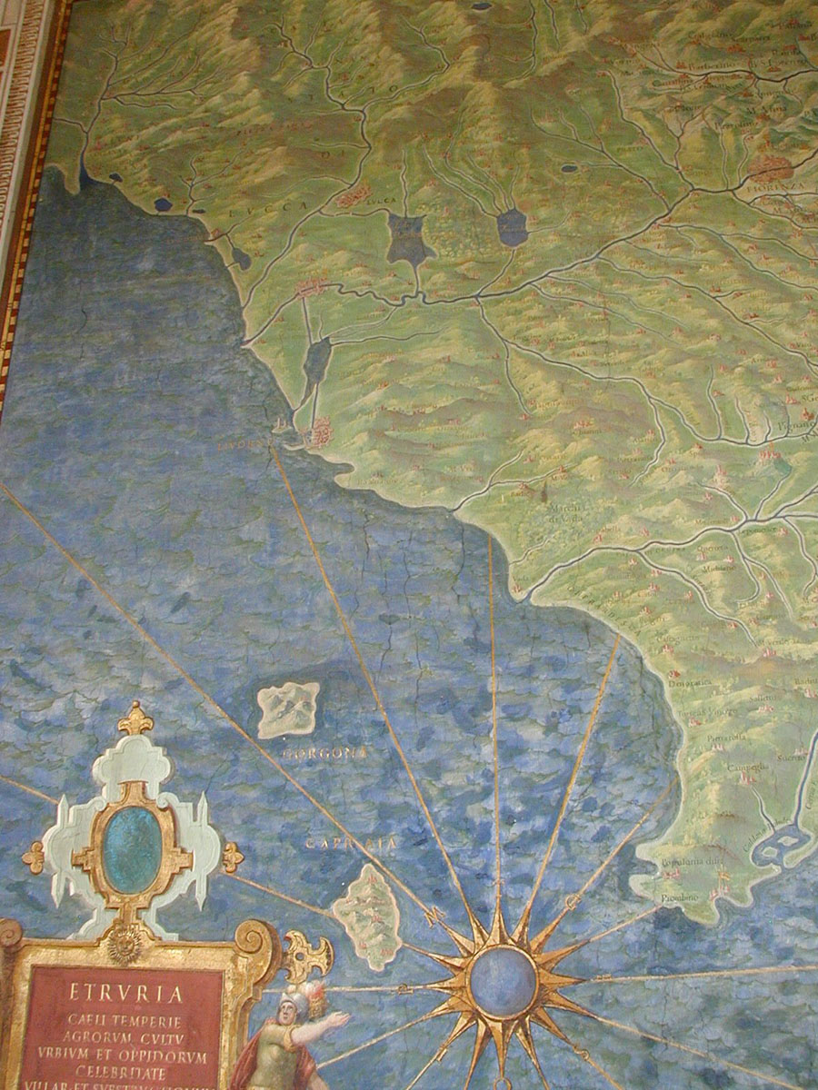
This map is of Etruria, with Livorno at its focus.
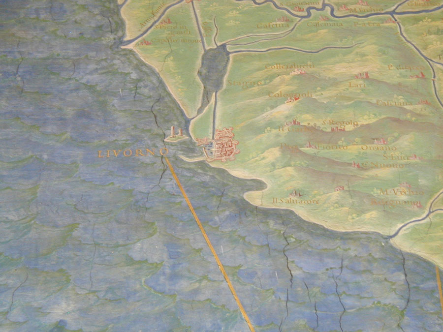
This detail from the previous map shows Livorno with two lighthouses at its entrance.
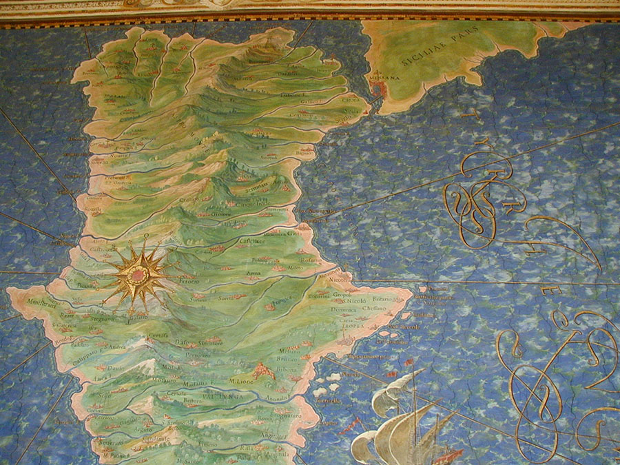
This map shows Scicily and the Straits of Messina.
A closeup of the previous map.
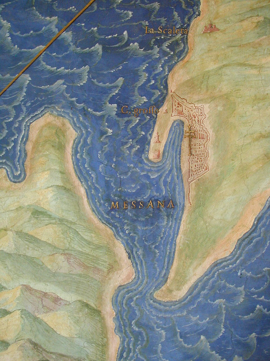
A closeup of the Straits of Messina.
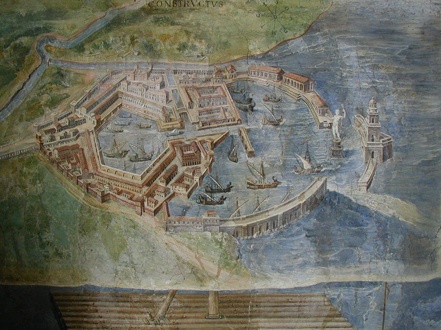
A detailed painting of the Port of Ostia.
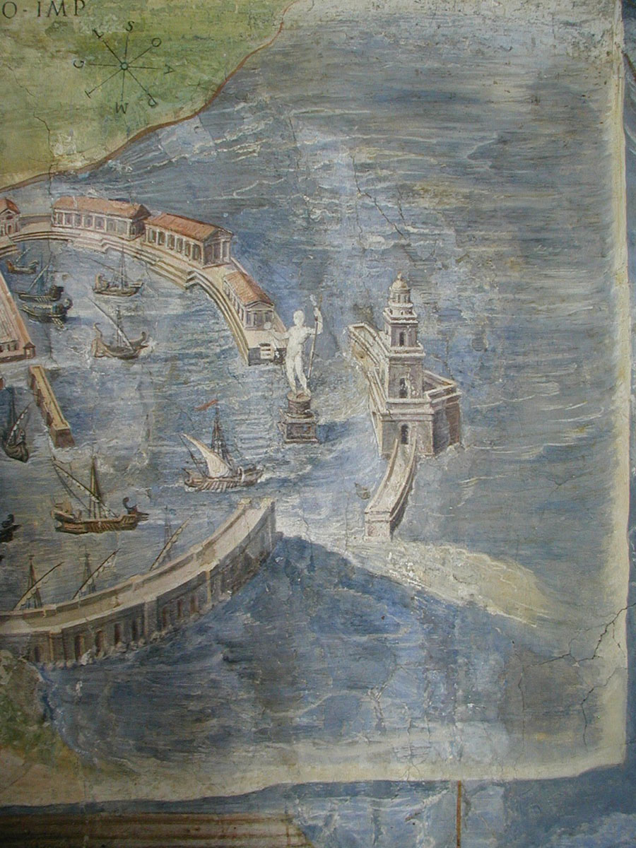
A beautiful closeup of the Port of Ostia.
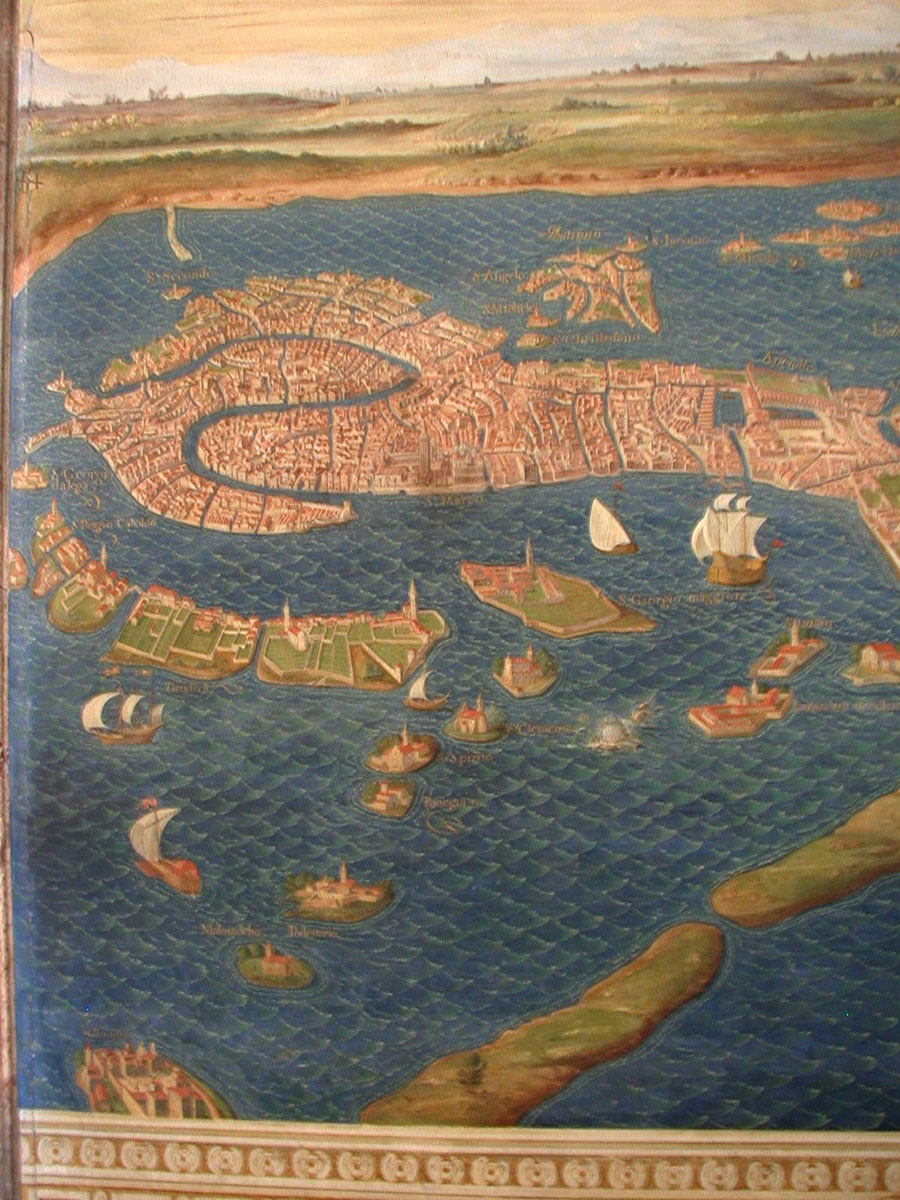
The map of Venice.